
Oliver Fritz
©2021 Oliver Fritz
Template by Bootstrapious.com
& ported to Hugo by Kishan B
Impressum (German)
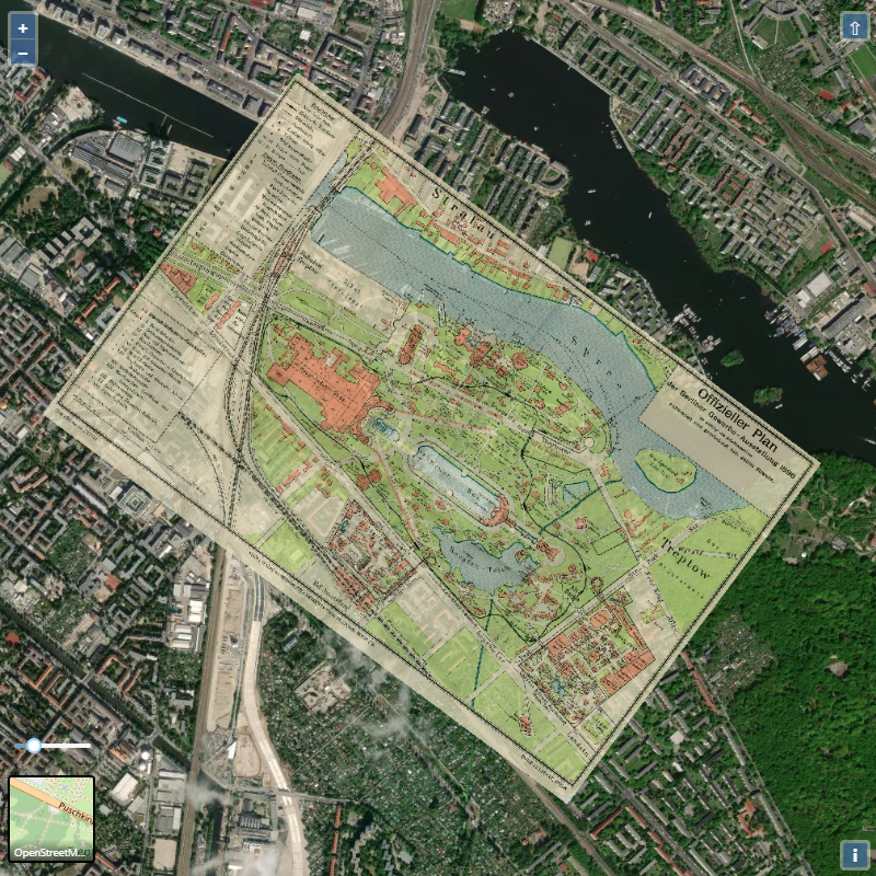
Berlin Industrial Expo 1896
Find the traces of an "impeded world fair" in today's Treptow Park, Berlin
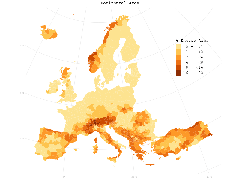
Unfolding Europe
Can one small country be larger than Europe when flattening all its mountains?
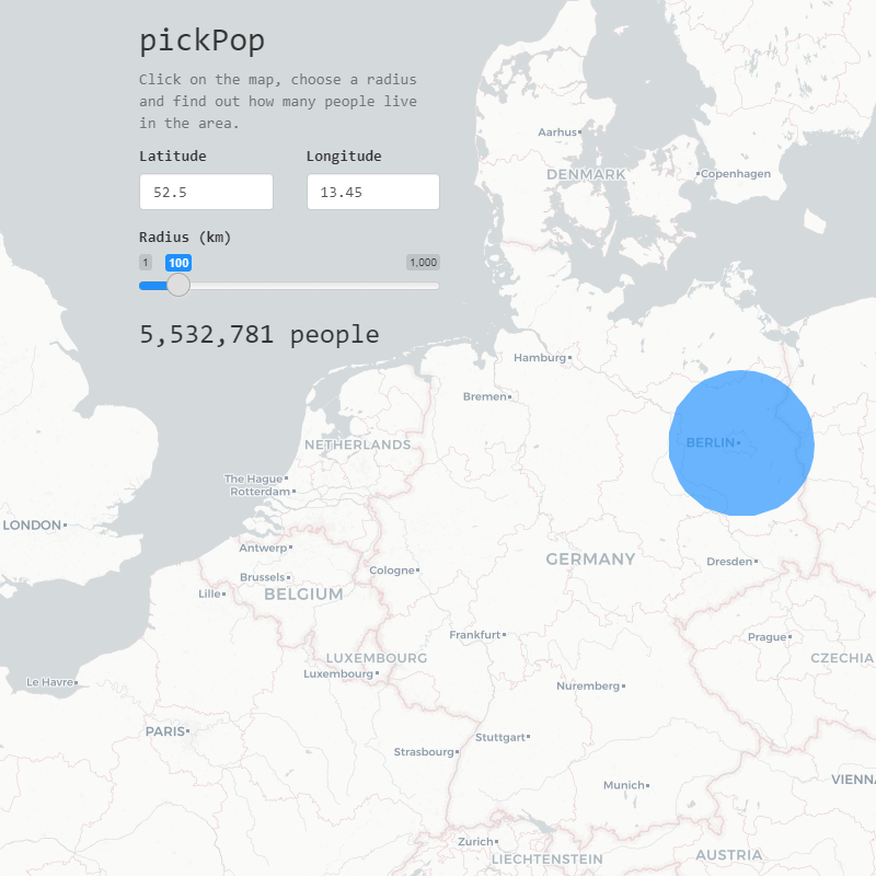
Introducing pickPop
Discover the number of people living within a radius around any point on Earth.
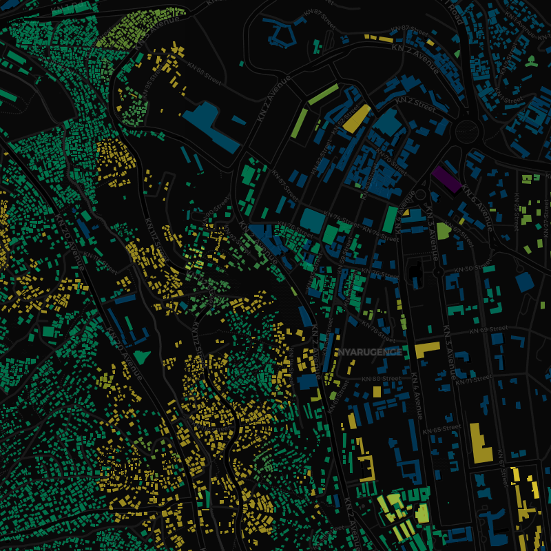
History of OSM Building Features in Kigali
Just a few lines of R code to make an interactive map of Kigali's building feature history on OpenStreetMap using the ohsome API.
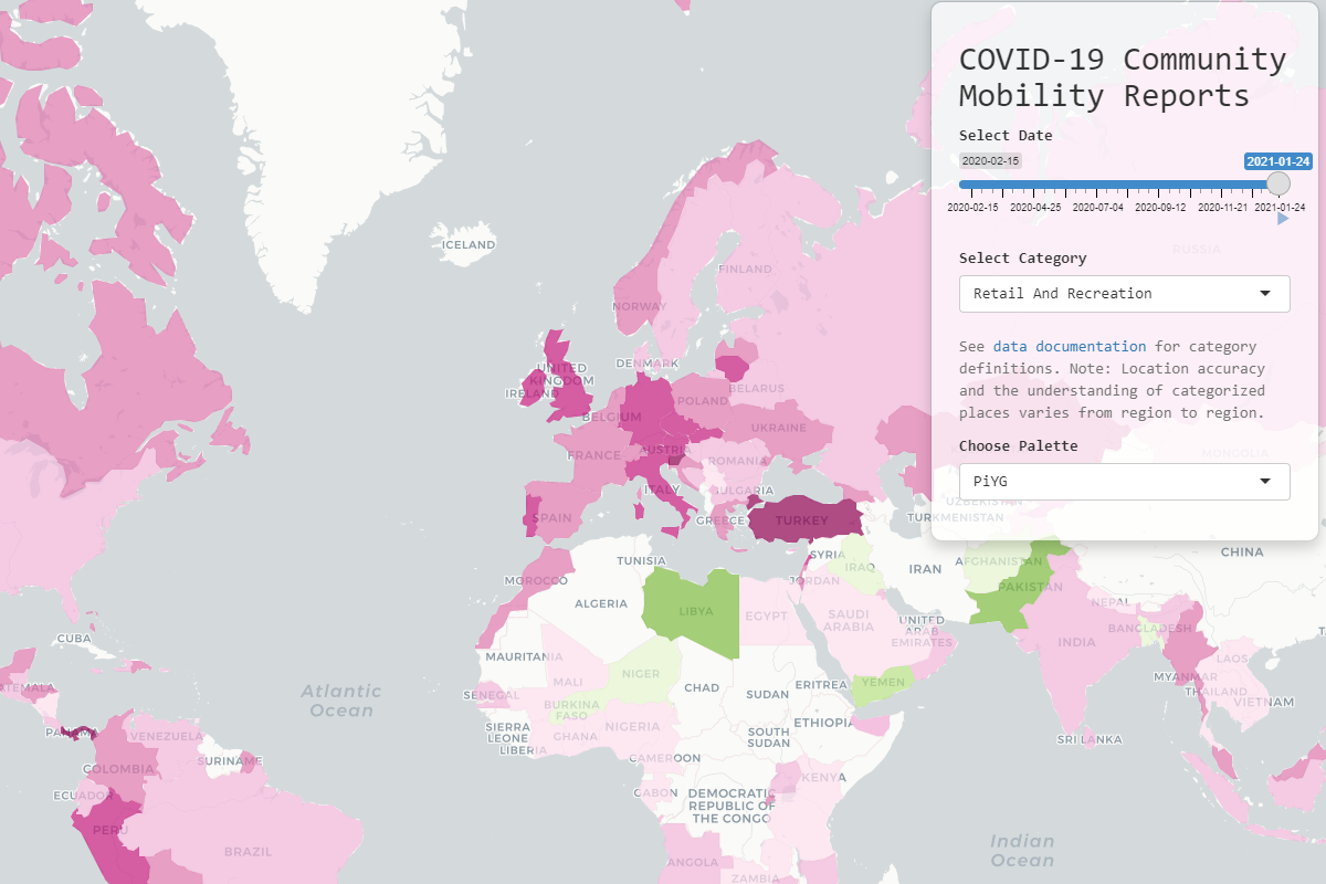
COVID-19 Community Mobility Reports
Visualising changes in mobility from Google's dataset with Shiny and Leaflet.
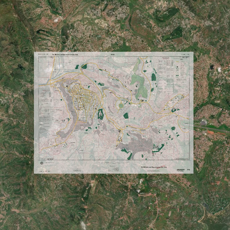
Kigali 1994 City Map
A beautifully simple 1994 map of Kigali, combined with current satellite imagery, shows the changes to the city.
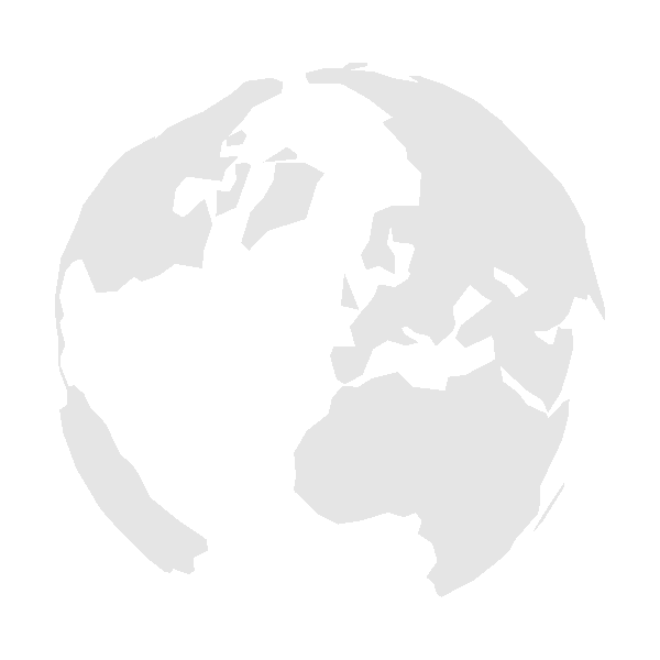
Hello, world!
A world globe favicon made for this website with ggplot2.